Hillforts of Gwent - In Search of the Iron Age
From a 2001 dissertation by Caroline Martin
Wilcrick – Bishton
By Caroline Martin
First published 2001
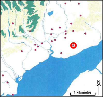
Location of Wilcrick – Bishton
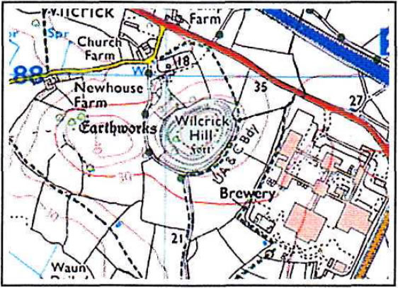
Wilcrick as seen on the OS Explorer 152
Image reproduced with kind permission of Ordnance Survey and Ordnance Survey of Northern Ireland
Wilcrick Hill Camp (ST 411 878) is in the Parish of Bishton and is 60 m OD. The hillfort stands on a steep sided hill entirely covered with woodland. In places, the woods are very deep and impenetrable. The defenses consist of scarps and terraces on the steepest side of the hill. On the south side, the defences of this site consist of a single scarp on the north side and a double scarp at the top and bottom of the hill on the other sides. The defenses as they exist now, are not very pronounced. The interior of the camp is pasture and the slopes of the camp are wooded. On the southern side of the hill, four scarps are discernible although they are only slightly steeper than the natural slope of the hill hi places. Where they are clearly visible they are about 3m in height. On the eastern side, the hill slopes less steeply and the scarps are very fragmented. Towards the north end of this side, a hollow way slopes 25 up the hill north east to south west. The slope is approximately 3.5m wide and 0.8m deep and is very overgrown. The northern side of the hill is very steep and a scarp is visible about halfway up at 3-4m high, which continues around to the western side (Taylor 1999, 5).