Hillforts of Gwent - In Search of the Iron Age
From a 2001 dissertation by Caroline Martin
Twmbarlwm - Risca
By Caroline Martin
First published 2001
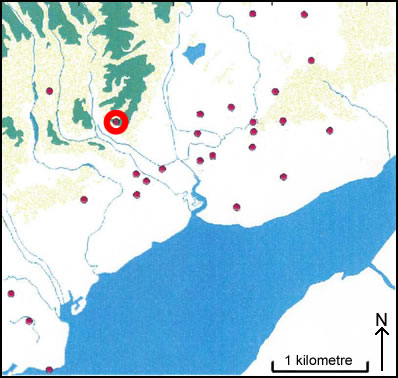
Location of Twmbarlwm
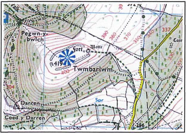
Twmbarlwm as seen on OS Landranger 171
Image reproduced with kind permission of Ordnance Survey and Ordnance Survey of Northern Ireland
Twmbarlwm (ST 243 926) lies within the Parish of Risca at 420m OD. This site has been reoccupied during various periods of history. The area that the Iron Age hillfort covers has a diameter of at least 15 metres. In 1984, a restoration and landscape programme was carried out by the local authorities. The restoration work was carried out upon the Motte and Bailey Castle section that occupies the eastern edge of the mound. A bailey occupies the whole of the summit and is delineated by a large bank and ditch. There are a large number of gaps, particularly on the south and west sides. It has been suggested that the Motte and Bailey Castle were erected over an Iron Age hillfort and that the bank and ditch date from that period (Whittle 1992, 92). No extensive ground survey of the Iron Age occupation has been carried out at this site.