Hillforts of Gwent - In Search of the Iron Age
From a 2001 dissertation by Caroline Martin
Cae Camp - Llanhennock Fawr
By Caroline Martin
First published 2001
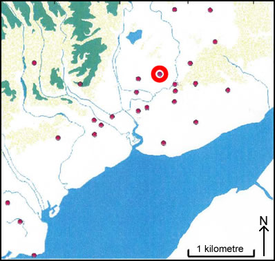
Location of Cae Camp - Llanhennock Fawr
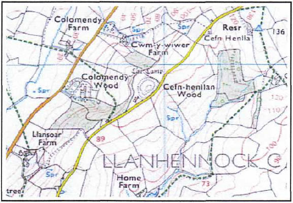
Cae Camp as seen on OS Explorer map 152
Image reproduced with kind permission of Ordnance Survey and Ordnance Survey of Northern Ireland
Cae Camp (ST 359 936) is in the parish of Llanhennock Fawr. The site is situated on the ridge top between the Usk Valley, 4.8 km from Caerleon and 8 km, from Usk and is 110m OD. The site consists of a small area enclosed within a double defence. The defences are not very well defined due to ploughing. The best section at the time of the survey carried out by CADW in 1987 (this is the last recorded description), at the southern end which shows evidence of a wide berm between the first and the second rampart. The only entrance is at the south east end of the site facing the present day road. There is a road that has been diverted through the eastern side of the ditch. The camp is roughly circular in shape and the centre shows signs of quarrying. There is an inner scarp 2.2m in height with a 15m berm outside of this, there is also a further scarp approximately 1.7m high. There is a short stretch of ditch outside of this scarp which measures 3m wide and 0.5m depth on the outside. This has, however, been cut off by the present road at the eastern end. There appears to be a quantity of erosion to the outer scarp. Along the western side the berm is narrower and slopes to the south western side. Further to the north, the slope forms into a faint ditch of 4m wide and 0.7m deep. The outer bank is 1.8m high on the outside. The northern side is similar, 22 with the edge of the outer bank forming on the hedge line forming the field boundary, it would appear that here the edge has been steepened. Along the eastern side, there is a berm that measures llm wide with an outer scarp measuring 2.2m high.