Hillforts of Gwent - In Search of the Iron Age
From a 2001 dissertation by Caroline Martin
The Mount Penylan? – Pontllanfraith?
By Caroline Martin
First published 2001
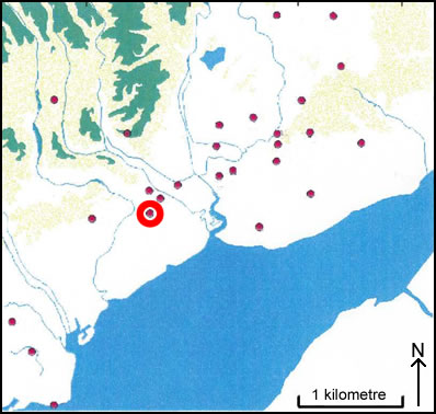
Location of The Mount Penylan – Pontllanfraith
The Mount, Penylan as seen on OS Landranger 171?
Image reproduced with kind permission of Ordnance Survey and Ordnance Survey of Northern Ireland
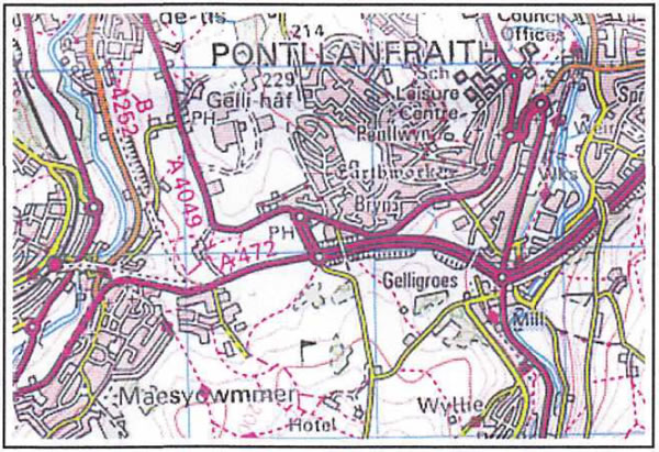
The Mount (ST 174 954) lies within the Parish of Pontllanfraith and is 180m OD. This site is situated on a south facing slope in the middle of a housing estate. It is a grass covered area with a few ornamental trees planted at the southern end. A road called Highfield crosses the site towards the southern end. The monument consists of a square earthwork on a sloping bank and ditch. North of the road on the eastern side the bank is 11m wide with an internal height of 0.3m and an external height of 1m. The ditch is flat bottomed and measures 2.5m wide. Outside it is a low bank 0.4m high on the ditch side and 0.3m high on the outside. The bank is prominent in the north east corner, with an internal and external height of 1.5m. Along the north side the bank has an internal height of 1.5m and an external height of 0.3 to 0.5m. The ditch is 2.5m wide. The west side north of the road is similar to the eastern side with an external bank. The bank has an internal height of 0.8m and an external height of 1m. The ditch is 3m wide and 0.8m deep. The interior is mostly flat sloping gently to the south with faint ridges and a hollow in the north eastern corner. South of the road, the ground slopes more steeply and the site is covered in rougher grass and scattered trees. There is an electricity substation on the edge of the western side. Below the road is a 28 scarp 1.5m high and below this a 5m wide berm. The south eastern corner of the site is just showing but has been cut across by an access road.