Hillforts of Gwent - In Search of the Iron Age
From a 2001 dissertation by Caroline Martin
Gaer Camp - Maindee, Newport
By Caroline Martin
First published 2001
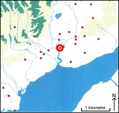
Location of Gaer Camp - Maindee, Newport
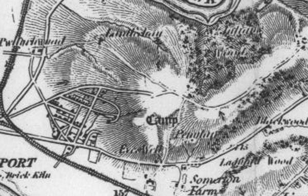
Maindee - Gaer Camp as seen on 1883 OS Map
Image reproduced with kind permission of Ordnance Survey and Ordnance Survey of Northern Ireland
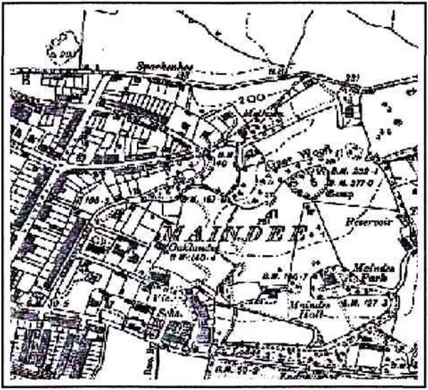
Gaer Camp - Maindee as seen on 1902 OS map
Image reproduced with kind permission of Ordnance Survey and Ordnance Survey of Northern Ireland
Maindee is an area in Newport that is now a busy suburb. The area was once in the possession of private landowners, who sold their land in the late nineteenth century. Upon this land, there once stood a hillfort known as the 'Gaer Camp'; this was sold as part of an auction in 1895. There are no traces of this hillfort left today; it has been completely obliterated by a modern day housing estate. Whilst conducting research of old documentation at Newport Reference Library the following document has been brought to light.
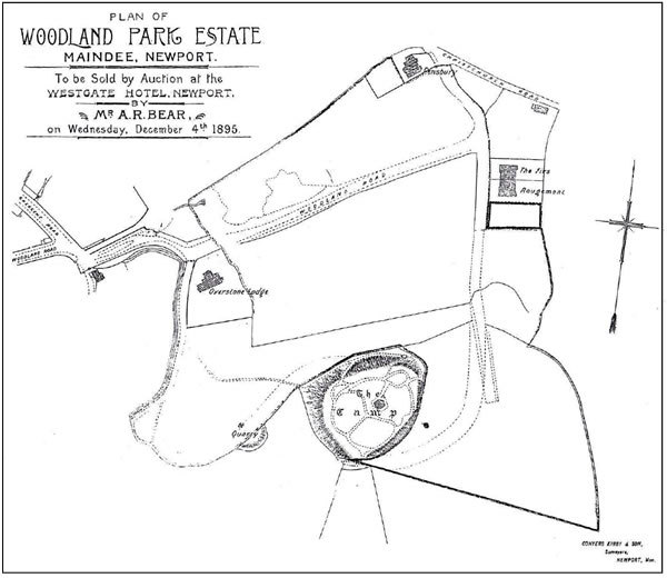
Plan of the Woodland Park Estate Maindee Newport 1895 showing "The Camp"
Possibly the only evidence that is left of the existence of the hillfort that once stood in this area. No traces of this site are evident on modern Ordnance Survey maps, though it is still evident but only just on the 1902 OS map.