Hillforts of Gwent - In Search of the Iron Age
From a 2001 dissertation by Caroline Martin
Pen-y-lan Camp - Michaelston-y-Fedw
By Caroline Martin
First published 2001
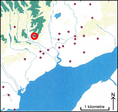
Location of Pen-y-lan Camp - Michaelston-y-Fedw
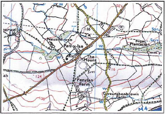
Pen-y-lan Camp as seen on OS Explorer 152
Image reproduced with kind permission of Ordnance Survey and Ordnance Survey of Northern Ireland
Pen-y-lan Camp (ST 258 848) is in the Parish of Michaelston-y-Fedw and is 125mOD (Figure 6). The site is situated on the top of a low ridge in a cultivated field. It is a circular earthwork and consists of a gentle sloping bank or scarp around a flat interior. On the north side, there is a bank with a very small internal height of 0.3m and an external height of 1.8m. Outside of this is a sloping berm and a gentle sloping scarp that measures 1.5m high. On the eastern side is a scarp of 1.5m high with a faint ditch outside it. On the south side there is a bank with a small internal height that is similar to one on the north side; this has an external height of 1.5m. There is no external ditch at the eastern end but the bank is steeper and there is an external ditch with a depth of 1.2m. On the western side, there is evidence of a very low scarp but no external ditch is evident (Taylor 1999, 5).