Hillforts of Gwent - In Search of the Iron Age
From a 2001 dissertation by Caroline Martin
Castell Prin - Penhow
By Caroline Martin
First published 2001
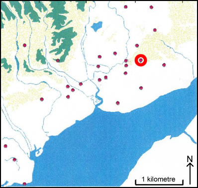
Location of Castell Prin - Penhow
??????????????????????????????????
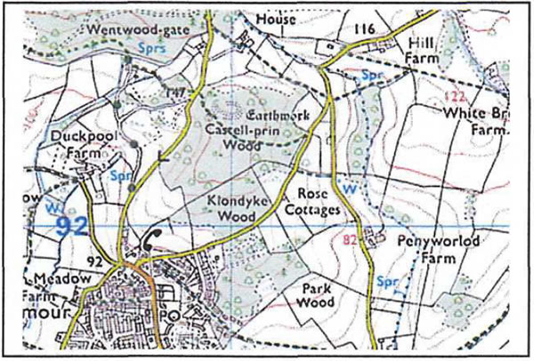
Castell Prin as seen on OS Explorer map 152
Image reproduced with kind permission of Ordnance Survey and Ordnance Survey of Northern Ireland
Castell Prin Camp (ST 410 924) is in the Parish of Penhow at 160m OD. The site is in a wood on a small hilltop to the south of Wentwood. It occupies the western end of the hill, where the ground slopes away to the north, west and south quite steeply. The site is oblong in shape with a flattish ulterior. The western half of the north side has no man-made defenses, only a steep natural slope. Towards the eastern end, a bank and ditch begins abruptly. The ditch is 1.2m deep and the bank has an external height of 2.5 to 3m and an internal height of 0.8m. These continue along the eastern side where the sides are very steep. The ditch ends abruptly at the south eastern corner. The bank continues along the south side with an internal height of 0 to 0.5m and an external height of 2.5m. Outside of this bank there is a berm 5m wide which in places become a shallow ditch and bank and has a height of 0.5m. Below this is a steep scarp which is 2.5m high, the ground levels out below this. In the middle of this side there is an in-turned entrance that measures 2.5m wide and 0.7m to 1m deep. There is a wide berm between them. The outer scarp becomes a low bank towards the south with a steep scarp which is similar in appearance to the one that is on the south side. At the bottom of the slope is a farm track. In the middle of this side is a short stretch of 26 an outer ditch and bank. The ditch measures 3m wide and 1.2m deep, the outside bank measures 1.2m high on both sides. The site is saucer shaped and is surrounded by a 4m deep ditch and a slight outer bank. There is also evidence of a further outer bank on the western side. The whole area is being used to cultivate saplings.