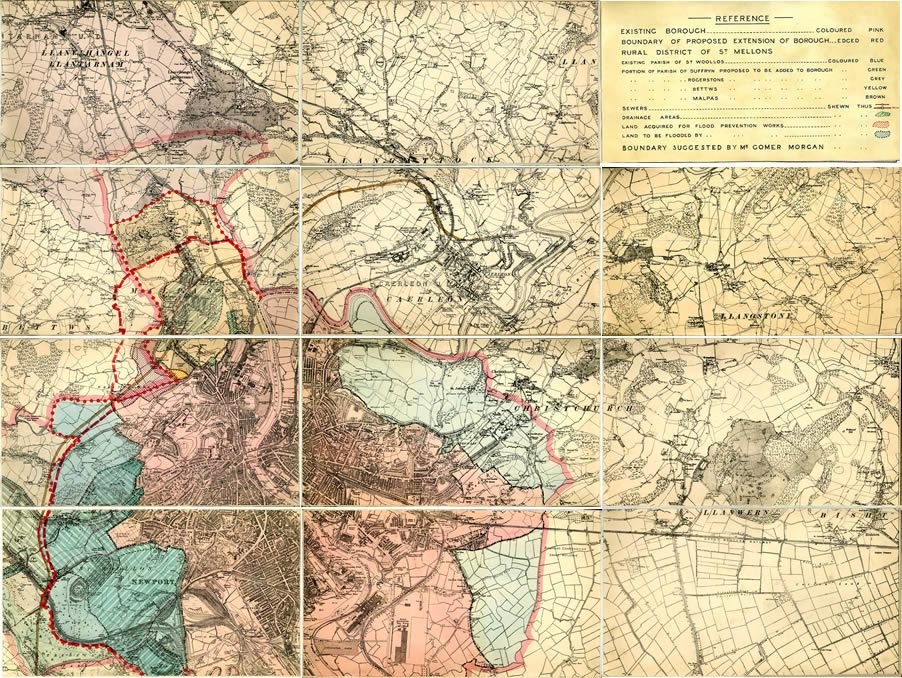
In addition to showing proposed boundary changes and drainage / flood prevention works, this OS map has what appears to be a proposed Newport Bypass marked on it.
The road is delineated by a pair of dashed lines and coloured brown in places. To some extent, it roughly covers the route now taken by the M4 motorway - starting at Tredegar Park. Once it reaches Crindau (Kimberley) Park it follows a completely different path. It passes to the north west of the park and runs up Malpas Pitch branching off past the Three Blackbirds public house and then round behind (to the north of) Lodge Hill. It joins the Ponthir Road north of Caerleon and branches off it just north of the town to join the Usk road for a short distance. It soon branches off this over the fields now taken by the Ryder Cup golf course, crossing the River Usk (near where a bridge is soon to be built for the course). It continues across the fields to climb through the gap in the hills where the present A449 runs to pass through Cats Ash and join Chepstow Road at Langstone by the New Inn public house.